Abstract
The concentration, type, and extent of sea ice in the Arctic can be estimated based on measurements from satellite active microwave sensors, passive microwave sensors, or both. Here, data from the Advanced Scatterometer (ASCAT) and the Special Sensor Microwave Imager/Sounder (SSMIS) are employed to broadly classify Arctic sea ice type as first-year (FY) or multiyear (MY). Combining data from both active and passive sensors can improve the performance of MY and FY ice classification. The classification method uses C-band σ0 measurements from ASCAT and 37 GHz brightness temperature measurements from SSMIS to derive a probabilistic model based on a multivariate Gaussian distribution. Using a Gaussian model, a Bayesian estimator selects between FY and MY ice to classify pixels in images of Arctic sea ice.
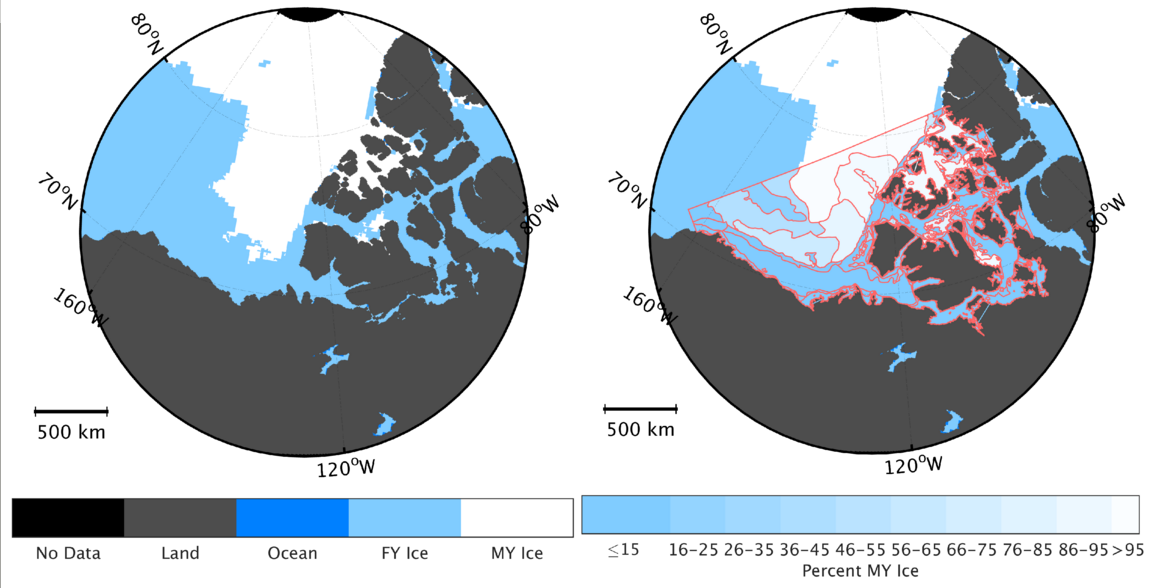
The ASCAT/SSMIS classification results are compared with classifications using the Oceansat-2 scatterometer (OSCAT), the Equal-Area Scalable Earth Grid (EASE-Grid) Sea Ice Age dataset available from the National Snow and Ice Data Center (NSIDC), and the Canadian Ice Service (CIS) charts, also available from the NSIDC. The MY ice extent of the ASCAT/SSMIS classifications demonstrates an average difference of 282 thousand km - + from that of the OSCAT classifications from 2009 to 2014. The difference is an average of 13.6% of the OSCAT MY ice extent, which averaged 2.19 million km2 over the same period. Compared to the ice classified as two years or older in the EASE-Grid Sea Ice Age dataset (EASE-2+) from 2009 to 2012, the average difference is 617 thousand km2 . The difference is an average of 22.8% of the EASE-2+ MY ice extent, which averaged 2.79 million km2 from 2009 to 2012. Comparison with the Canadian Ice Service (CIS) charts shows that most ASCAT/SSMIS classifications of MY ice correspond to a MY ice concentration of approximately 50% or greater in the CIS charts. The addition of the passive SSMIS data appears to improve classifications by mitigating misclassifications caused by ASCAT’s sensitivity to rough patches of ice which can appear similar to, but are not, MY ice.
Citation
@article{lindell2016multiyear,
  title={Multiyear {Arctic} ice classification using {ASCAT} and {SSMIS}},
  author={Lindell, David B and Long, David G},
  journal={Remote Sensing},
  volume={8},
  number={4},
  pages={294},
  year={2016},
  publisher={Multidisciplinary Digital Publishing Institute}
}